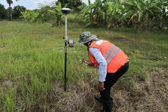

Geospatial and Surveying Services
We offer a comprehensive range of land surveying services, including geodetic, topographic, engineering, hydrographic, territorial, cadastral, and aerial surveys, utilizing advanced equipment and technology for high precision mapping, property valuation, urban planning, and environmental monitoring.

Earth Observation and Climate Resilience
We use advanced geospatial technologies for Earth Observation and Climate Resilience, providing satellite data analysis, disaster management, water resource planning, environmental monitoring, land use policy support, and feasibility studies to enhance sustainability and resilience.

Sustainable Agriculture Services
Our Sustainable Agriculture Services leverage geospatial technologies and engineering solutions for efficient irrigation, land use analysis, water management, and sustainable agricultural development.

Invention and Innovation of Surveying Equipment
We specialize in high-end surveying equipment design and integration, offering advanced solutions that include developing and manufacturing cutting-edge technologies such as drones, Mobile Mapping Surveying (MMS) systems, and Maglev Obstacle Detection Systems based on Laser Radar.

Construction and Engineering Consultancy
We provide comprehensive construction and engineering consultancy services, specializing in project management, cost estimation, structural and civil engineering, urban planning, interior design, and environmental impact assessments to ensure efficient execution, sustainability, and aesthetic excellence.
Research Project Consultancy
We offer expert geospatial, environmental, and engineering research support, including methodological design, data analysis, technical report writing, grant proposal development, and manuscript editing to enhance research quality and impact.
Servicing and Calibration of Mapping Equipment
We provide expert servicing and calibration for mapping equipment, including drones, total stations, and GNSS/GPS devices, ensuring precision, reliability, and compliance with international standards for optimal performance in surveying, geomatics engineering, and construction applications.
Smart Surveying for Construction and Infrastructure Monitoring
Our services utilize advanced technologies, including drones, mobile mapping, and other geospatial tools, to provide accurate, real-time spatial data. These services help enhance decision-making, safety, and efficiency in complex development projects across multiple sectors.

Wanda Sphere Ltd’s advanced GIS solutions and geostatistical expertise have significantly improved the accuracy of spatial analysis in urban planning. Their precision calibration ensures reliable geospatial data for decision-making.
Dr. Liangliang Zhou
Urban Geospatial Specialist and Consultant

Wanda Sphere Ltd’s UAV-based surveying and photogrammetry services have been instrumental in our research. Their expertise in drone calibration and multi-sensor integration has optimized data quality for complex observation missions.
Dr. Akram Akbar
PostDoc Researcher at Tongji University, Expert in Photogrammetry and UAV Integration

From urban redevelopment to sustainable land management, Wanda Sphere Ltd’s geospatial and calibration services have provided crucial support for precise mapping and informed urban planning decisions.
Prof. Yishao Shi
Professor at Tongji University, Urban and Regional Planning Specialist